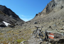
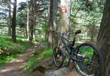
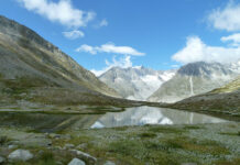
Tra gli alpeggi dell’Alto Verbano vi è un’alpe non molto nota, l’Alpe Casola. Raggiungerla non è cosa semplice ma riuscire a farlo ripaga delle fatiche per arrivarci.
..
Parto da Verbania e da Renco comincio a costeggiare il torrente San Giovanni.
I start from Verbania and from Renco I begin to drive along the St. Giovanni Creek.
Raggiungo Trobaso e comincio a salire verso Cambiasca. Da Cambiasca imbocco la strada sterrata che mi porterà a Ramello. Giunto a Ramello attraverso il paese e salgo verso la strada provinciale della Valle Intrasca.
Percorro questa strada in direzione di Aurano. Una serie di tornanti in salita mi fanno raggiungere la piazzetta di Aurano con il suo belvedere sulla valle.
I reach Trobaso and start to climb towards Cambiasca. From Cambiasca I take the dirt road that will take me to Ramello. Arriving at Ramello I across the village and I get to the provincial road of the Intrasca Valley.
I drive this road in the direction of Aurano. A series of bends uphill make me reach the square of Aurano with its lookout over the valley.
Continuo a salire percorrendo la strada. La salita si fa più impegnativa e dopo un paio di tornanti raggiungo l’Alpe Segletta.
I continue to go up along the road. The climb is more challenging and after a couple of turns I reach the Alpe Segletta.
Qui lascio la strada asfaltata per imboccare una strada sterrata che dopo un pò diventa sentiero a mezza costa fino a giungere il fondo valle nei pressi di un ponte in legno.
Here I leave the asphalt road to go down a dirt road after a while becomes a trail until I reach the bottom of the valley near a wooden bridge.
Superato il ponte riprendo il sentiero e dopo un breve tratto a spinta raggiungo la Corte dei Ratti. Un ultimo tratto e sono ad Alpe Pianale.
After crossing the bridge I take the trail and after a short walkon foot I reach Corte dei Ratti. A final stretch and I am in Alpe Pianale.
Esco dall’alpe e prendo una strada sterrata che in salita e dopo una serie di tornanti mi fa raggiungere la strada asfaltata. Volto a sinistra e raggiungo rapidamente Alpe Colle. Da qui imbocco il sentiero in direzione delle gallerie del Monte Morissolo.
I exit from Alpe, take a dirt road uphill and after a series of bends it makes me reach the asphalt road. Face to the left and I quickly reach Alpe Colle. From here I take the trail in the direction of the galleries of Mount Morissolo.
Breve visita alle gallerie e, quindi, per comodo sterrato panoramico raggiungo Piancavallo, nei pressi del Centro Auxologico.
Short visit to the galleries and, therefore, by scenic dirt road I reach Piancavallo, near the Auxological Center.
Riprendo la strada asfaltata in discesa fino a giungere al punto panoramico.
I take the asphalt road downhill until I reach the lookout point.
Da qui imbocco una strada sterrata con una sbarra ed inizio a scendere con decisione. Attraverso alcuni tornanti e successivamente il sentiero si restringe fino a raggiungere la località “La Barca”.
From here I take a dirt road with a bar and start to come down firmly. I through a few turns and then the trail narrows until I reach the place “La Barca”.
Piego a destra e continuo a scendere su sentiero a tratti sconnesso, fino a raggiungere Alpe Casola con il suo punto panoramico sul lago.
I turn to the right and continue down on the trail at times bumpy, up to Alpe Casola with its panoramic view of the lake.
Da qui imbocco la strada sterrata e raggiungo Manegra nei pressi di un tornante. Prendo, quindi, la strada in discesa ed arrivo a Luera. Da Luera in leggera salita raggiungo Pian di Sole. Quindi in discesa fino a Premeno e poi Pian Nava.
Da Pian Nava prendo la strada sterrata che scende ad Albagnano, quindi per asfalto fino a Bée, dove, ancora per comodo sterrato raggiungo la strada provinciale. Attraverso il bosco di S.Martino e sono a Vignone. Breve tratto asfaltato ed arrivo a Bureglio. Qui prendo il sentiero che scende a Ramello e da Ramello, rifacendo il percorso iniziale, raggiungo Verbania.
From here I take the dirt road and reach Manegra near a bend. Then I take the asphalt road downhill and arrive at Luera. From Luera uphill I reach Pian di Sole then downhill to Premeno and then Pian Nava.
From Pian Nava I take the dirt road that goes down to Albagnano, so by asphalt to Bée, where, again by dirt road I reach the provincial road. Then I through the forest of St. Martino and arrive at Vignone. Short stretch of asphalt and I arrive at Bureglio. Here I take the trail that goes down to Ramello and from Ramello, redoing the initial path, I reach Verbania.
(km 53, dislivello totale in salita circa 1200 m)
(km 53, total climb uphill about 1200 m)


