Un lungo itinerario che da Verbania raggiunge una cima dell’Alto Verbano altamente remunerativa.
Da Intra mi dirigo verso Trobaso costeggiando il torrente S. Bernardino.
From Intra I go towards Trobaso along the St. Bernardino Creek.
Quindi salita su asfalto verso Cambiasca e da qui per sterrato raggiungo Ramello.
So climb on asphalt towards Cambiasca and from here dirt road to reach Ramello.
Attraverso il paesino in salita e mi immetto sulla strada provinciale della Valle Intrasca, direzione Aurano. Lungo la strada scorci sul torrente San Giovanni.
Uphill through the village and I get on the provincial road of Intrasca Valley, in direction of Aurano. Along the road views of the St. Giovanni Creek.
Dopo il bivio Aurano-Scareno inizia la salita per Aurano, diversi tornanti non troppo ripidi. Raggiungo, così, la piazzetta di Aurano da dove si può ammirare la valle.
After the Aurano-Scareno fork begins the ascent to Aurano, several bends, not too steep. I reach, thus, the square of Aurano from where I can admire the valley.
Riprendo la salita, che da qui in poi si fa più dura e dopo alcuni strappi raggiungo l’Alpe Segletta.
I resume the climb, which becomes harder and after a few bends I reach the Alpe Segletta.
Verso le ultime case lascio l’asfalto e prendo il comodo sterrato che poi diventa sentiero a mezza costa e raggiungo il fondo valle nei pressi di un ponticello.
Towards the last houses I leave the asphalt and take the dirt road which then becomes trail and I reach the valley bottom near a bridge.
Riprendo il sentiero, per qualche tratto non pedalabile, raggiungo la Corte dei Ratti, la attraverso per imboccare un ultimo strappo e raggiungo Calpera.
I pass the bridge and retake the trail, for some trait not pedaled, and I reach Corte dei Ratti, I through some hut and take a last steep stretch then I reach Calpera.
Da qui posso già ammirare la cima da scalare che mi aspetta.
From here I can already see the top waiting for me to climb.
Uscito da Calpera prendo la strada sterrata in salita caratterizzata da una serie di tornanti.
I exit from Calpera and take the dirt road uphill characterized by a series of bends.
La salita è dura e offre continui scorci sul monte che mi aspetta.
The climb is hard and offers panoramic views of the mountain waiting for me.
Una serie di strappi e raggiungo la strada asfaltata. A sinistra ed arrivo ad Alpe Colle.
A series of bends and I arrive at the road. To the left and I arrive at Alpe Colle.
Rifornimento di acqua e poi imbocco la strada sterrata che parte da dietro il parcheggio. La strada sale senza strappi di rilievo e già all’inizio comincia ad offrire un bel panorama.
Water supply and then the dirt road that starts from behind the parking. The road climbs not hard and begins offering a beautiful landscape.
La salita non molla mai, ma la cima si avvicina.
The climb never gives up, but the top is approaching.
La traccia si restringe nella parte finale. Per un ultimo tratto poi bisogna spingere a piedi, ma la cima è proprio là davanti.
The track narrows in the final part. For the last part then I have to push on foot, but the top is right there in front.
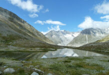
Con il cielo che c’è oggi lo spettacolo che offre la cima è unico.
With the sky of today there is a beautiful landscape on the top.
Qui regna la perfezione.
Resterei qui per ore, ma mi aspetta ancora tanta strada. Per la discesa scelgo il sentiero che in direttissima scende il versante nord del monte. A tratti non molto pedalabile.
Here perfection reigns.
I could stay here for hours, but I expect a long way. For the descent I choose the trail that goes down along the north slope of the mountain. At times not much pedaling.
Al culmine della discesa raggiungo Pian d’Alpe. Volto a destra e prendo il comodo sterrato che mi riporterà ad Alpe Colle.
At the end of the descent I reach Pian d’Alpe. Face to the right and take the easy dirt road that will take me back to Alpe Colle.
Da Alpe Colle prendo il sentiero in direzione delle gallerie del Monte Morissolo, un divertente e veloce sentiero a mezza costa.
From Alpe Colle I take the trail in the direction of the galleries of Mount Morissolo, a fun and fast trail.
Giunto ai piedi del Morissolo mi immetto sulla strada sterrata molto panoramica in direzione di Piancavallo.
At the foot of the Morissolo I get on the very scenic dirt road in the direction of Piancavallo.
Raggiunto il Centro Auxologico prendo la strada asfaltata in discesa, ancora una breve sosta al punto panoramico per ammirare un’ultima volta il lago.
Reached the Auxological Center I take the asphalt road downhill, even a brief stop at the viewpoint to admire the lake one last time.
Quindi in veloce discesa su asfalto raggiungo Alpe Manegra e poi Luera. Da qui la strada comincia leggermente a salire fino a Pian di Sole. Dove devio a destra per una scorciatoia in direzione di Premeno.
Then in rapid descent on asphalt I reach Alpe Manegra and then Luera. From here the road begins to rise slightly to Pian di Sole. Here I switch for a shortcut to the right in the direction of Premeno.
Attraversata Premeno raggiungo Pian Nava e da qui prendo la strada sterrata in direzione di Albagnano.
After Premeno I reach Pian Nava and from there I take the dirt road in the direction of Albagnano.
Raggiunta Albagnano riprendo la strada asfaltata in direzione di Bée. Alle 17.30 Albagnano è ancora baciata dal sole.
Reached Albagnano I take the asphalt towards Bée. At 17.30 Albagnano is still bathed in sunlight.
Raggiungo anche Bée e imbocco la strada sterrata che porta a Bureglio.
I reach Bée too and take the dirt road that leads to Bureglio.
Volto a sinistra sulla strada provinciale e dopo qualche centinaio di metri prendo il sentiero a destra che si immerge nel bosco di S. Martino, un intrico di sentieri.
Face to the left on the main road and after a few hundred meters I take the trail on the right that immerses in the woods of St. Martino, a tangle of trails.
A Vignone mi dirigo verso Bureglio, da qui parte un divertente sentiero che mi porterà a Ramello, ormai il sole sta calando.
In Vignone I go towards Bureglio, from here starts a fun trail that will take me to Ramello, now the sun is going down.
Sono nuovamente sullo sterrato fatto in mattinata, lo riprendo e mi dirigo verso Cambiasca, dove mi attende la stessa fauna che ho lasciato in mattinata.
I’m back in the dirt road done in the morning, take it back and I go towards Cambiasca, where I expected the same fauna that I left in the morning.
Discesa veloce verso Trobaso e di nuovo a costeggiare il torrente San Bernardino, ma con una luce diversa.
Fast descent towards Trobaso and again along the St. Bernardino Creek, but in a different light.
Ancora poche centinaia di metri e sono di ritorno a Intra.
Just a few hundred meters and I am back to Intra.
(km 57, dislivello totale in salita circa 1490 m)
(km 57, total climb uphill about 1490 m)


