Il classico percorso che sale a Piancavallo attraversando l’Alpe Segletta.
..
..
Parto da Verbania in direzione di Trobaso, da dove inizio a salire verso Cambiasca. Da qui piego in direzione di Aurano, supero Ramello in salita e mi addentro nella Valle Intrasca.
I start from Verbania in direction of Trobaso, from where I start to climb towards Cambiasca. From here in the direction of Aurano, overcome Ramello uphill and I enter in the Intrasca Valley.
Costeggio il Torrente San Giovanni, che offre sempre degli scorci gradevoli, ancor di più con la neve.
I drive along the St. Giovanni Creek, which always offers some viewpoints, even more so with the snow.
Raggiungo rapidamente il bivio Aurano-Scareno, volto a destra e inizio a salire verso Aurano. Una serie di tornanti non troppo ripidi e raggiungo la piazzetta di Aurano, con il suo belvedere sulla valle.
I quickly reach the junction Aurano-Scareno, turn to the right and start to climb towards Aurano. A series of bends not too steep and I get the square of Aurano, with its lookout over the valley.
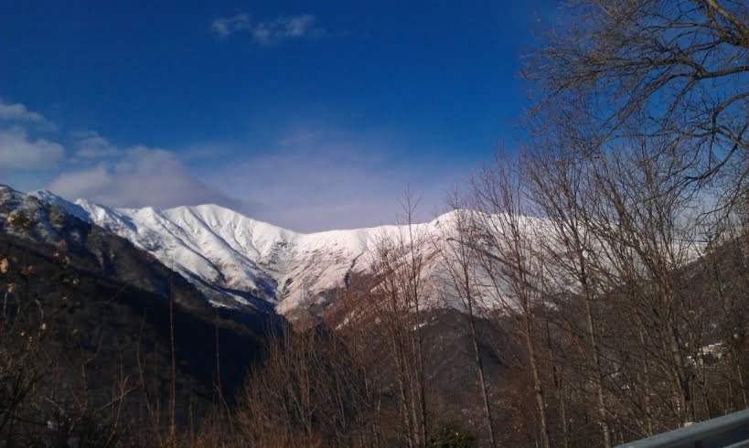
Riprendo la salita e già da qui si intravedono il Monte Zeda e il Monte Vadà completamente innevati.
I resume the climb and from here I can already see the Mount Zeda and Mount Vadà with snow.
La salità si fa più dura, un paio di tornanti e raggiungo l’Alpe Segletta che con la neve sembra una cartolina.
The climb is tougher, a couple of bends and I reach the Alpe Segletta with snow that looks like a postcard.
La strada prosegue ancora ripida, qualche altro tornante e poi gradualmente spiana fino a raggiungere il bivio con la strada proveniente da Premeno.
Sono a Piancavallo con il suo stupendo belvedere.
The road continues still steep, some other bend and then gradually flattens until I reach the junction with the road from Premeno.
I am in Piancavallo with its magnificent landscape.
Da qui prendo la strada per Premeno in discesa e raggiungo rapidamente l’Alpe Manegra.
From here I take the road to Premeno downhill and rapidly I reach the Alpe Manegra.
Dopo l’Alpe raggiungo Luera e da qui la strada inizia a salire leggermente in direzione di Pian di Sole.
After I reach Luera and from here the road starts to rise slightly in the direction of Pian di Sole.
Raggiungo Pian di Sole e prendo la vecchia strada per Tornicco immersa nel bosco, fino ad arrivare al belvedere Cadorna, altro bel panorama.
I reach Pian di Sole and take the old road to Tornicco deep in the woods, until I get to the Cadorna’s lookout, another beautiful view.
Attraverso Premeno e mi dirigo verso Pian Nava seguendo la vecchia strada che parte dal ristorante. Da Pian Nava evito ancora la strada principale e mi immetto su una strada secondaria che passando sotto Roncaccio mi fa raggiungere Bée. Seguo, stavolta, la strada principale, quindi devio per Vignone, Zoverallo e raggiungo Verbania.
I through Premeno and go towards Pian Nava along the old road from the restaurant. From Pian Nava I still avoid the main road and I enter on a secondary road which passing under Roncaccio makes me reach Bée. I follow, this time, the main road, then switch for Vignone, Zoverallo and reach Verbania.
(km 39, dislivello totale in salita circa 1100 m)
(km 39, total climb uphill about 1100 m)


