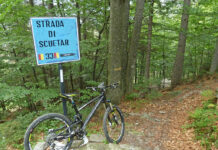
Un itinerario impegnativo che dopo una lunga salita si tuffa nella valle di Calpera per poi raggiungere la zona di Piancavallo: alta quota con splendidi panorami sul Lago Maggiore.
..
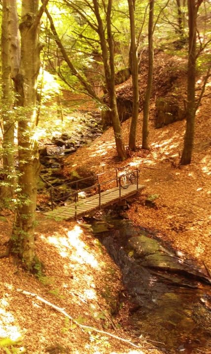
Da Verbania verso Trobaso prendo la pista ciclabile da Renco che poi lascio per prendere il sentiero che costeggia il Torrente San Bernardino.
From Verbania to Trobaso I take the bike path from Renco then I leave it to take the trail along the St. Bernardino Creek.
Riprendo la strada e salgo a Cambiasca, da dove imbocco la strada sterrata che conduce a Ramello.
I take the road and I get to Cambiasca, from where I take the dirt road that leads to Ramello.
A Ramello attraverso il paesino in salita e raggiungo la strada provinciale della Valle Intrasca, che percorro in direzione di Aurano. Lungo la strada diversi scorci sul Torrente San Giovanni.
In Ramello uphill through the village and I reach the provincial road of Intrasca Valley, that I drive towards Aurano. Along the way different views of the St. Giovanni Creek.
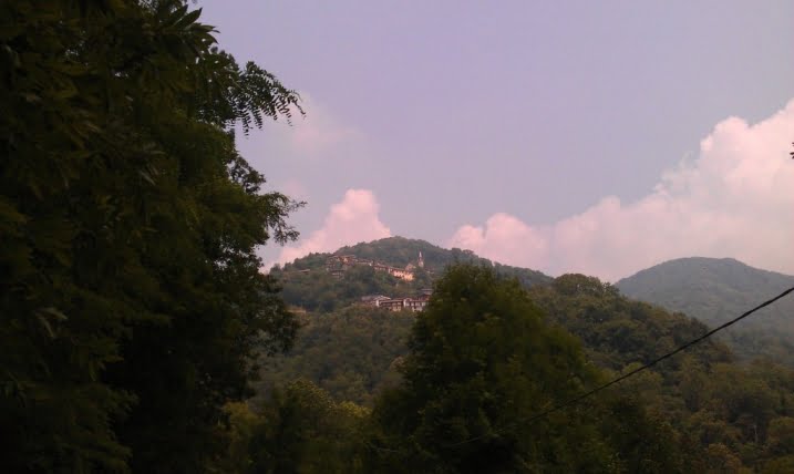
Intanto comincio ad avvistare Aurano.
Meanwhile, I begin to sight Aurano.
Inizio a salire verso Aurano, una serie di tornanti e raggiungo la piazzetta del paese con il suo belvedere sulla valle.
I start to climb towards Aurano, a series of hairpin bends and I reach the village square with its lookout over the valley.
Da qui la salita è più dura, qualche altro tornante ed arrivo all’Alpe Segletta. Lascio l’asfalto e prendo la strada sterrata che conduce a Calpera. Un comodo sterrato che poi diventa sentiero e raggiunge uno splendido fondo valle.
From here the climb is tougher, some other hairpin bends and I arrive at Alpe Segletta. I leave the asphalt and take the dirt road that leads to Calpera. An easy dirt road that then becomes a trail and reaches a beautiful valley bottom.
Ricomincio a salire, qualche tratto non molto pedalabile e raggiungo la Corte dei Ratti. La attraverso, un ultimo strappo e sono ad Alpe Pianale.
I start to go up, some not easily pedaled stretches and I reach Corte dei Ratti. I through it, one last steep stretch and I am in Alpe Pianale.
Da qui proseguo su strada sterrata in salita, una serie di tornanti ripidi ed arrivo sulla strada asfaltata nei pressi di Piancavallo, quindi in leggera discesa raggiungo Alpe Colle.
From here I continue on uphill dirt road, a series of steep hairpin bends and I arrive at the asphalt road near Piancavallo, then slightly downhill I reach Alpe Colle.
Ora prendo il sentiero accanto alla fontana e mi dirigo verso le gallerie del Monte Morissolo, un divertente single-track.
Now I take the trail near the fountain and I go towards the galleries of Mount Morissolo, a fun single-track.
Raggiungo le pendici del Monte Morissolo, dove posso visitare le gallerie militari della Linea Cadorna. Da qui prendo la panoramica strada sterrata che conduce al Centro Auxologico di Piancavallo.
I reach the slopes of Mount Morissolo, where I can visit the military galleries of the Cadorna Line. From here I take the scenic dirt road that leads to the Auxological Center of Piancavallo.
Arrivato sulla strada asfaltata la prendo in discesa e raggiungo rapidamente il belvedere di Piancavallo, ultimamente in fase di ristrutturazione.
Arrived on the asphalt road I take it down and quickly reach the viewpoint of Piancavallo, recently being renovated.
Continuo a scendere su asfalto e, superata Alpe Manegra, arrivo a Luera, da dove riprendo a salire.
I continue to go down on asphalt and, after Alpe Manegra, I arrive at Luera, from where I restart to rise.
La salita non è dura, arrivo a Pian di Sole e da qui prendo la vecchia e breve stradina che porta a Premeno.
The climb is not hard, I arrive at Pian di Sole and from here I take the old and short road that leads to Premeno.
Quindi in discesa su asfalto, fino a raggiungere Pian Nava, da dove prendo la strada sterrata che porta ad Albagnano, da dove si può ammirare uno splendido panorama.
Downhill on asphalt, until I reach Pian Nava, from where I take the dirt road that leads to Albagnano, where there is a splendid landscape.
Da Albagnano raggiungo rapidamente Bée, dove prima su strada sterrata e poi su sentiero scendo verso Bureglio.
From Albagnano I quickly reach Bée, where before by dirt road and then by trail to go down Bureglio.
Da Bureglio su divertente single-track raggiungo Ramello, dove riprendo la strada sterrata fatta precedentemente che mi porta a Cambiasca. In discesa verso Trobaso dove riprendo il sentiero che costeggia il Torrente San Bernardino e che mi riporta a Verbania.
From Bureglio by a fun single-track I reach Ramello, where I take the dirt road previously made that leads me to Cambiasca. Downhill towards Trobaso where I take the trail along the St. Bernardino Creek and that leads me back to Verbania.
(km 51, dislivello totale in salita circa 1180 m)
(km 51, total climb uphill about 1180 m)


